Europe is the sixth largest continent in size and the third largest in population. It is bordered by the Mediterranean Sea to the south, Ural Mountains to the east, and the Atlantic Ocean to the West. Europe is a wealthy continent and is the center of the West and Western Democracy.
Here you have all the kahoots:
HERE YOU CAN HAVE A GENERAL REVIEW OF ALL THE EXAM: CLICK HERE
Kahoot Political Map 1: PLAY HERE
Kahoot Political Map 2: PLAY HERE
European Geography: PLAY HERE
European Mountains: PLAY HERE
European Peninsulas: PLAY HERE
European Islands: PRACTICE HERE
Seas and Oceans: PRACTICE HERE
You can watch Europe from Google Earth.
Let's now see the relief map of Europe:
Europe has been the home to a variety of civilizations including Ancient Greece and the Roman Empire. It is also the home to the birth of democracy. Europe has been the central point of two of the biggest wars in modern history: World War I and World War II.
Recently Europe has united under a common union called the European Union. This union allows independent European countries to have a single currency and to combine their economic and military power.
We are going to study the following points:
Here you can have the definitions:
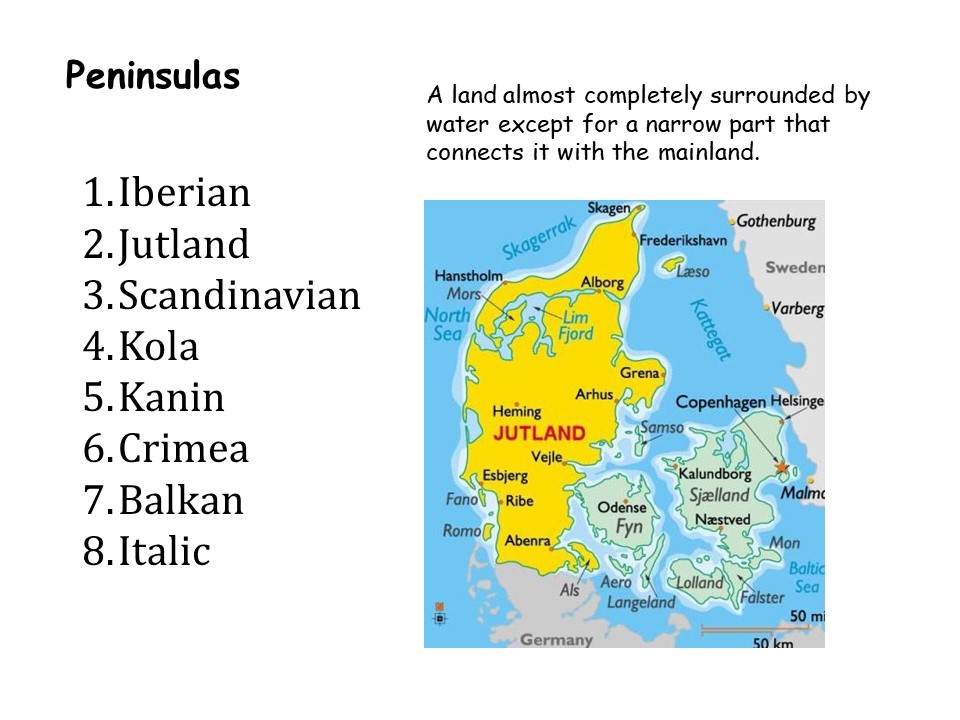
Peninsula: A piece of land almost entirely surrounded by water, connected to a larger landmass by a narrow strip.
Mountain: An elevated landform with a peak, typically rising steeply from its surroundings and generally above 700 meters in elevation.
River: A natural flowing watercourse that usually empties into a larger body of water, such as an ocean or a sea.
Island: A piece of land completely surrounded by water.
Sea: A large body of saltwater.
Ocean: The vast, continuous body of saltwater that covers most of Earth's surface.
Plain: A flat expanse of land, often part of a larger geographic region, characterized by its low relief and minimal variation in elevation.
Latitude:
Latitude is a geographical coordinate that indicates how far a specific location is from the Earth's equator, measured in degrees. It is also known as a "parallel" because lines of constant latitude form circles parallel to the equator. The equator itself is at 0 degrees latitude, and as you move north, the latitude values increase, while moving south results in decreasing latitude values. Latitude is an essential component of the global coordinate system, helping to specify a point's position in a north-south direction on the Earth's surface.
Longitude:
Longitude is a geographical coordinate that indicates the east-west position of a specific location on the Earth's surface, typically measured in degrees. It is also referred to as a "meridian." The Prime Meridian, located in Greenwich, England, serves as the starting point for measuring longitude, and it is assigned a value of 0 degrees. Locations to the east of the Prime Meridian have positive longitude values, while those to the west have negative values. Longitude is a crucial component of the global coordinate system, helping to pinpoint a point's position in an east-west direction on the Earth's surface.


This comment has been removed by the author.
ReplyDeleteHola Simon dond está lode las Baleares Palma
ReplyDeleteHi Simon i don can enter in the Kahoot
ReplyDeleteHellooooo, Natalia I think that is because this slides are of time ago
DeleteHi! Natalia, some kahoots are now activated, you can use them!!!
Delete